
Hutchinson's address trail has both current and historical layers. Reno County was organized in 1872, so land evidence can predate the modern street number and every online system. Printed directories document selected years from 1887-88 onward. Sanborn maps preserve building and street context across editions from 1884 through 1950. Modern tax and GIS records then connect a present situs to a parcel, subdivision, block, lot, or section-township-range description. The task is to bridge those layers without treating any one of them as a complete list of people.
Use the source date as part of every result. A tax page may be current while its deed reference points decades back. A directory line reflects one edition. A permit records one project. An annexation ordinance changes legal jurisdiction but not necessarily the USPS label. When two records disagree, compare their stated role before choosing one: owner, taxpayer, grantee, subscriber, applicant, and registered voter are not synonyms for resident. This discipline is especially useful on numbered avenues, directional streets, and parcels near Hutchinson or South Hutchinson boundaries.
Online failure also has several meanings. Tyler may stop at its acceptance screen, Beacon may not expose a live card, GovWell may not render controls, and an old deed image may await digitization. The correct fallback is the responsible office, not an unsupported conclusion. Keep the parcel ID, legal description, name spelling, date range, and any book/page reference ready for that request.
Walk a Hutchinson Street
A street-by-street search works as a chain. The Reno County tax roll identifies a parcel and current owner, not everyone inside the building. The GIS map supplies shape and neighboring parcels. Recorded deeds move the trail back through owners. VoterView can confirm one known person when the searcher has that person's name and birth date. Historical reverse directories may connect an old address with a subscriber or householder.
- Enter street number, name, and direction in the Reno County tax search. Save the situs address, parcel number, owner, and legal description.
- Open the county parcel map route and inspect the target and adjacent lots separately.
- Use the owner and legal description in the Register of Deeds index. A parcel-card deed reference may supply the first book and page.
- Confirm a known person through Kansas VoterView only with the required name and birth date.
- For earlier households, ask Hutchinson Public Library for a directory year close to the date researched.
This sequence avoids calling an owner, taxpayer, voter, subscriber, or permit applicant an occupant without proof. Each source has its own purpose and date.
Hutchinson Street Directory Fields
The tax module supports a true by-address search. It separates Street Number, Street Name, Street Direction, and ZIP Code, then offers subdivision, block, and lot controls. Direction matters in Hutchinson. Old and new records use W 1st Ave, N Main, av E, and N Plum. Leaving it out can mix two places or miss the right lot.
| Search field | Input | Use |
|---|---|---|
| Street Number | House number | Targets one situs |
| Street Name | Name or avenue | Supports a street pass |
| Street Direction | Direction | Separates address forms |
| ZIP Code | Postal code | Narrows a postal field |
| Subdivision, Block, Lot | Land fields | Bridges to plats and deeds |
| Owner/Taxpayer | Name | Checks owner, taxpayer, or both |
The page offers real estate, personal property, oil, gas, truck, mineral, and state-assessed utility tax types. Choose real estate for a house or city lot. Its segmented CAMA number is an internal tax ID, not a mailing address or full legal description.
Separate Hutchinson Address Types
A county parcel sample makes the distinction plain. The situs, meaning physical, address is 500 W 20th Ave. The owner mailing line is PO Box 1987 with a different Hutchinson ZIP. The report also carries Parcel ID 1210204011007000, Quick Ref R11838, College Hill subdivision, Block 13, zoning, acreage, tax unit, and deed references. None says who was physically present.
Insider tip. Preserve situs and mailing fields as labeled. A mailing address is an owner clue, never proof of occupancy.
Keep four facts separate: physical address, owner mail, USPS city and ZIP, and legal description. A permit may use the project site. A deed rests on land description. A voter record uses registration residence. Different values can all be right.
Hutchinson Records By Address
No Hutchinson street directory contains every relevant name. These sources overlap, yet each proves a different point.
| Record | Keeper | Evidence | Access |
|---|---|---|---|
| Tax roll | Appraiser/Treasurer | Owner, taxpayer, situs, mail, parcel | Tax module; 620-694-2915 |
| GIS map | Reno County GIS | Boundaries, roads, aerial, zoning | County links and Beacon |
| Deeds/plats | Register of Deeds | Parties, land, recording refs | Tyler, office, copy request |
| Voter confirmation | VoterView/Elections | One supplied person's registration | Name and birth date |
| Permit/code file | Hutchinson | Project and public filing data | GovWell or KORA request |
| Old listing | HPL/KSHS | Subscriber or householder clue | Shelf, microform, request |
The county clerk is not the deed or court-file custodian. Send land documents to the Register of Deeds, parcel questions to the Appraiser, and city permit requests to Hutchinson.
Map Hutchinson Parcel Layers
Reno County instructions identify parcel, 2016 zoning, and aerial layers. In Beacon, zoom to the road, click one polygon at a time, and copy each parcel ID and legal description. Research did not confirm a public radius, buffer, export, or measure tool. When the map fails, return to the tax module and search the next street number.
The city keeps a separate zoning map. County and city layers serve distinct aims, and neither is a resident roster. A map proves adjacency, land form, road context, and zoning. It cannot show who is home. For a whole street, keep one dated row per parcel.
- Parcel
- A mapped unit of land with a county identifier.
- Situs address
- The physical parcel location, distinct from owner mail.
- Plat
- A recorded map of subdivisions, blocks, lots, roads, or easements.
- Criss-cross directory
- A directory arranged by street and number instead of surname.
Trace Hutchinson Deeds by Street
The Reno County Register of Deeds records land instruments, mortgages, liens, and plats. Start from today's owner as grantee, the party receiving an interest. In that deed, the grantor conveys it. Search the seller next as an earlier grantee. The legal description is often safer than the street label.
The Tyler public access page first requires a records-use certification. Its full dynamic fields were not exposed in research. If the index stops, give the office names, date range, legal description, and book/page reference. Historical 1872 through 1990 material is still being added, so no online image does not mean no deed.
Open the official recorded-land screen before the deed portion of a Hutchinson search.
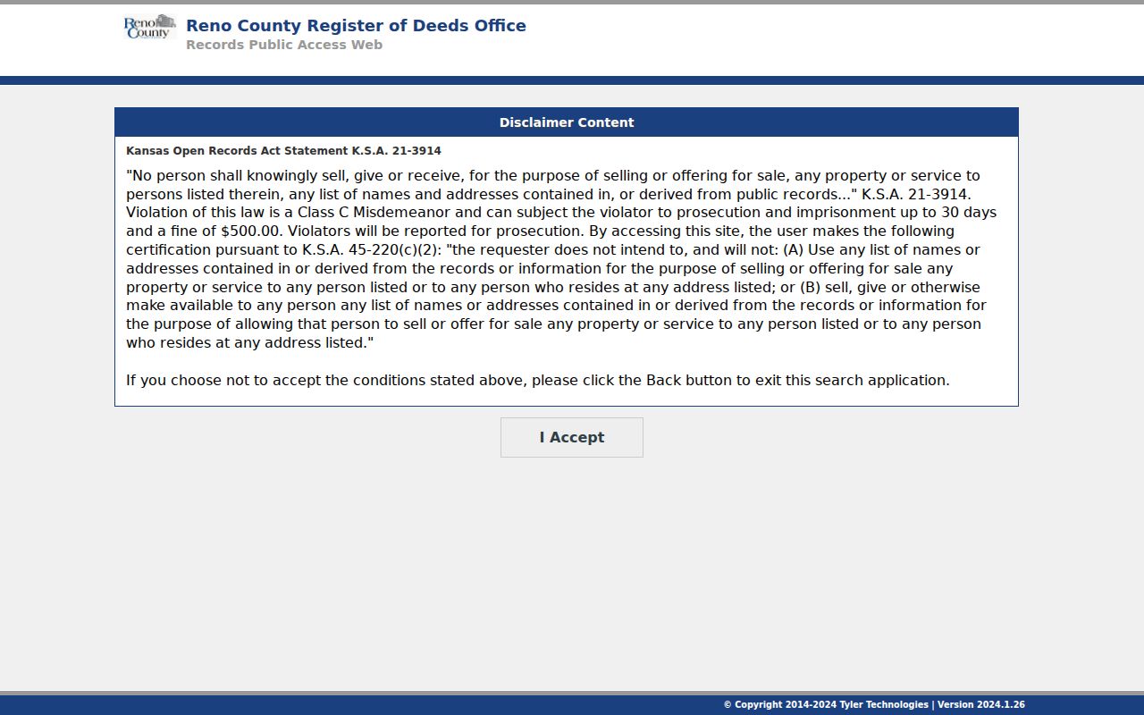
The screen marks the index entry and its legal-use warning. Filed copies are listed at $1 per page and certification at $13, with $1 added for fax or email. Confirm current fees.
Old Hutchinson Street Entries
The 1918 telephone transcription uses r for residence. The 1935 directory uses lines such as h321 10th av W, plus spouse notes, occupations, and firms. These are clues, not current facts. The Hutchinson city directory collections detail the runs and marks.
Criss-cross order lets a reader scan a block, but exact shelf years need confirmation from HPL. Ask with a street, number, name variant, and short date range. A missing entry may mean no subscription, a missing year, or a typo.
Sanborn maps add the building layer. Hutchinson sets run from 1884 through 1950, including a free 1922 Library of Congress set. They show footprint, lot, alley, street label, and use, not residents. Pair one with a directory and deed.
Request Hutchinson Permit History
Hutchinson links permits to GovWell, but the controls and date span did not render in research. Search the project address first. If it fails, use the city records request form. State the address, file type, and date range. The form lists staff time at $12 per hour and copies at $0.25 per page.
A file can date an addition, repair, demolition, or code action. An applicant, contractor, group owner, or former taxpayer is not always a resident. Record the role as shown.
Note: Ask for one address and one date range first so the custodian can locate and review the file efficiently.
Hutchinson Streets Cross Lines
Planning assigns addresses after parcel approval, while USPS controls ZIP codes. A 2018 annexation covered parts of rights-of-way along Hendricks, 43rd Avenue, 30th Avenue, Halstead Street, Avenue G, and Lorraine Street. Its descriptions use subdivision and section-township-range terms.
A postal label cannot settle whether land is inside Hutchinson. Check GIS and legal description. Ask Planning to confirm a rural or annexed situs. Hutchinson ZIP labels 67501, 67502, 67504, and 67505 do not define neighborhoods.
Confirm One Hutchinson Voter
VoterView requires first name, last name, and birth date. It cannot browse a block. A separate state request governs voter-file selections, fees, and use, and Kansas bars commercial use of voter-registration information.
Use it only to confirm a known person. No result can reflect spelling, scope, a move, or protection. It does not prove the person never lived there. Safe at Home can provide a substitute address.
Hutchinson Deed Books Still Move Online
Reno County's recorded-land system is in an active transition. The Register of Deeds moved to Tyler ERM in February 2025 while staff continued work on older books. A 2022 county inventory counted 226,794 digitized documents across 508 books, yet it also listed incomplete Section-Township-Range, subdivision, UCC, township-government-lot, and general index groups. Those figures describe that project snapshot, not the current count or a promise of complete online coverage.
A January 2026 county meeting summary reported that 14 of 18 land index books in the first phase had been digitized. The practical lesson for a Hutchinson by-street search is simple. A recent parcel card may display an old deed reference even when the linked historical image or name index does not appear online. Copy the book, page, parcel ID, subdivision, block, lot, and section-township-range before contacting the office. That reference gives staff a much stronger request than a street name alone.
The digitization history also explains why two neighboring parcels may have different online trails. One instrument group may be imaged while another index remains incomplete. Search the current owner, prior owner, legal description, and recorded reference in turn. If all four fail, ask for the older book or index rather than assuming that title history begins with Tyler. Hutchinson land evidence starts with Reno County's organization era, long before the public web portal.
Hutchinson Street Directory Limits
A street directory cannot reliably identify renters, guests, children, utility customers, delivery recipients, or each household member. Tax rolls concern land. Deeds concern title. Directories concern listed subscribers. Protected voter, sealed court, restricted vital, adoption, and motor-vehicle data stay outside this trail.
Lawful use. Use Hutchinson address records for lawful personal, property, family-history, or civic research. Never stalk, harass, threaten, or expose a protected person.
Commercial compilations may merge owners, old subscribers, and inferred ties without dates. A careful result states what the source proves, when it was viewed, and what remains unknown.